From the Blue Ridge to the salt marsh
Know the conditions.
Find your next place.
A South Carolina field guide with official weather and water data where it exists—and a clear “not connected” where it doesn’t.

A quick read
Three connected places
Ratings are planning signals, not safety guarantees.How they work
Statewide destination finder
Choose a destination on the map
Search, filter, and open a destination. Marker shape shows category; marker color shows condition status.
90 mapped ·90 weather ·90 total
No mapped destinations match those filters.
State outline: U.S. Census Bureau 2025 Cartographic Boundary File, 1:5,000,000. Destination coordinates are plotted through the same projection.
Browse all mapped destinations as links
- ACE Basin National Wildlife Refuge — Forests & Preserves, Lowcountry
- Aiken State Park — Parks, Midlands
- Andrew Jackson State Park — Parks, Midlands
- Ashley Scenic River — Rivers, Lowcountry
- Baker Creek State Park — Parks, Upstate
- Bald Rock Heritage Preserve — Mountains & Overlooks, Upstate
- Barnwell State Park — Parks, Pee Dee
- Battle of Musgrove Mill State Historic Site — Parks, Upstate
- Battle of Rivers Bridge State Historic Site — Parks, Pee Dee
- Black River State Park — Parks, Pee Dee
- Black Scenic River — Rivers, Pee Dee
- Botany Bay Heritage Preserve — Beaches, Coast
- Broad River — Rivers, Midlands
- Caesars Head State Park — Parks, Upstate
- Calhoun Falls State Park — Parks, Upstate
- Cape Romain National Wildlife Refuge — Beaches, Coast
- Carolina Sandhills National Wildlife Refuge — Forests & Preserves, Pee Dee
- Catawba Scenic River — Rivers, Upstate
- Cedar Creek — Rivers, Midlands
- Charles Towne Landing State Historic Site — Parks, Coast
- Cheraw State Park — Parks, Pee Dee
- Chester State Park — Parks, Midlands
- Colleton State Park — Parks, Lowcountry
- Colonial Dorchester State Historic Site — Parks, Lowcountry
- Congaree Boardwalk Loop — Trails, Midlands
- Congaree National Park — Parks, Midlands
- Congaree River — Rivers, Lowcountry
- Croft State Park — Parks, Upstate
- Devils Fork State Park — Parks, Upstate
- Dreher Island State Park — Parks, Midlands
- Edisto Beach State Park — Parks, Coast
- Folly Beach County Park — Beaches, Coast
- Foothills Trail — Trails, Upstate
- Francis Marion National Forest — Forests & Preserves, Lowcountry
- Givhans Ferry State Park — Parks, Lowcountry
- Goodale State Park — Parks, Midlands
- Great Pee Dee Scenic River — Rivers, Pee Dee
- H. Cooper Black Jr. Memorial Field Trial and Recreation Area — Parks, Pee Dee
- Hamilton Branch State Park — Parks, Upstate
- Hampton Plantation State Historic Site — Parks, Coast
- Hickory Knob State Resort Park — Parks, Upstate
- Hunting Island State Park — Parks, Coast
- Huntington Beach State Park — Parks, Coast
- Isle of Palms County Park — Beaches, Coast
- J. Strom Thurmond Lake — Lakes, Upstate
- Jocassee Gorges — Mountains & Overlooks, Upstate
- Jones Gap State Park — Parks, Upstate
- Keowee-Toxaway State Park — Parks, Upstate
- Kings Mountain State Park — Parks, Upstate
- Lake Greenwood State Park — Parks, Upstate
- Lake Hartwell State Park — Parks, Upstate
- Lake Jocassee — Lakes, Upstate
- Lake Keowee — Lakes, Upstate
- Lake Marion — Lakes, Lowcountry
- Lake Moultrie — Lakes, Lowcountry
- Lake Murray — Lakes, Midlands
- Lake Warren State Park — Parks, Lowcountry
- Lake Wateree — Lakes, Midlands
- Lake Wateree State Park — Parks, Midlands
- Lake Wylie — Lakes, Upstate
- Landsford Canal State Park — Parks, Upstate
- Lee State Park — Parks, Pee Dee
- Little Pee Dee Scenic River — Rivers, Pee Dee
- Little Pee Dee State Park — Parks, Pee Dee
- Lower Whitewater Falls — Waterfalls, Upstate
- Lynches Scenic River — Rivers, Pee Dee
- May Forest State Park — Parks, Coast
- Middle Saluda Scenic River — Rivers, Upstate
- Myrtle Beach State Park — Parks, Coast
- Oconee State Park — Parks, Upstate
- Oconee Station State Historic Site — Parks, Upstate
- Palmetto Trail — Trails, Midlands
- Paris Mountain State Park — Parks, Upstate
- Pine Island State Park — Parks, Midlands
- Poinsett State Park — Parks, Midlands
- Raven Cliff Falls — Waterfalls, Upstate
- Redcliffe Plantation State Historic Site — Parks, Midlands
- Rose Hill Plantation State Historic Site — Parks, Upstate
- Sadlers Creek State Park — Parks, Upstate
- Saluda River — Rivers, Midlands
- Santee National Wildlife Refuge — Forests & Preserves, Pee Dee
- Santee State Park — Parks, Lowcountry
- Sassafras Mountain — Mountains & Overlooks, Upstate
- Sesquicentennial State Park — Parks, Midlands
- St. Phillips Island — Parks, Coast
- Sumter National Forest — Forests & Preserves, Upstate
- Table Rock State Park — Parks, Upstate
- Wateree River — Rivers, Midlands
- Woods Bay State Park — Parks, Pee Dee
- Yellow Branch Falls — Waterfalls, Upstate
Weekend field notes
South Carolina outdoor ideas for September 11–13
Six flexible South Carolina outdoor ideas for September 11–13, with the weather, water, tide, alert, and access checks that should shape each plan.
Read the weekend roundup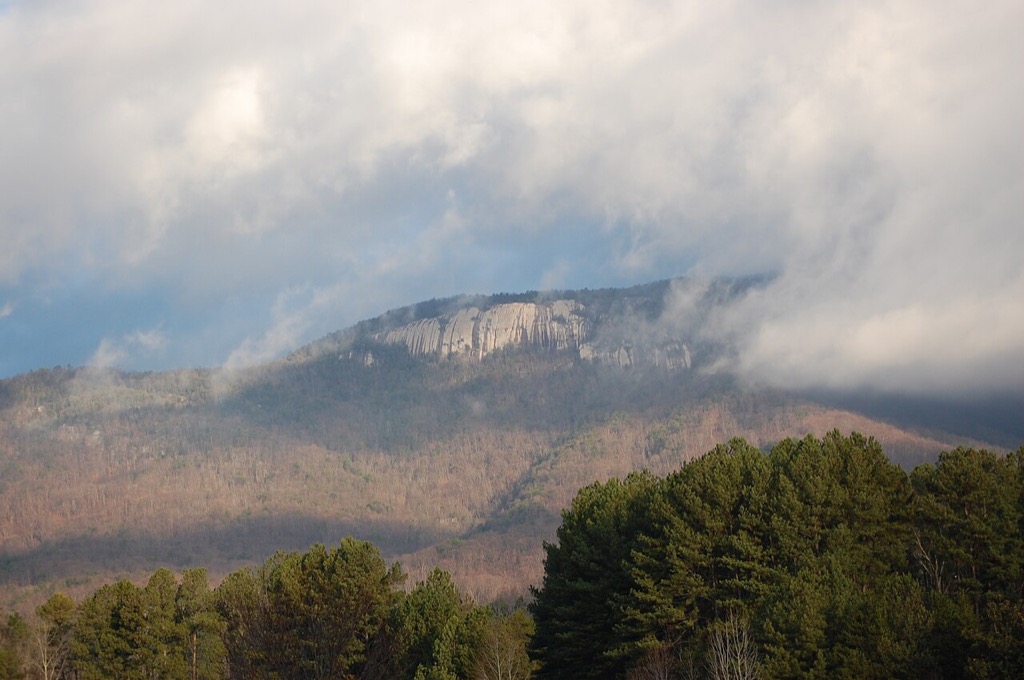

Editor’s pick · Early fall
Give Table Rock the cool hours
An early start preserves options on this sustained mountain hike. Check heat, storms, daylight, and the official South Carolina park notice, then keep a shorter route ready if the margin narrows.
Plan a Table Rock State Park visitSelected by SC Outdoor Check editorial team. Reviewed through 2026-10-31.Follow the land
Explore by region
Five landscapes, from cool mountain overlooks to wide coastal marsh.
Official feeds
Current notices
Check notices again before departure; conditions and closures can change quickly.
- Coastal Flood AdvisoryCoastal Flood Advisory issued September 8 at 6:55AM EDT until September 8 at 9:00PM EDT by NWS Charleston SCSource: National Weather Service
- Rip Current StatementRip Current Statement issued September 8 at 6:55AM EDT until September 8 at 8:00PM EDT by NWS Charleston SCSource: National Weather Service
- Coastal Flood AdvisoryCoastal Flood Advisory issued September 8 at 6:55AM EDT until September 8 at 9:00PM EDT by NWS Charleston SCSource: National Weather Service