Official notices
Active alerts
Know the place
Overview
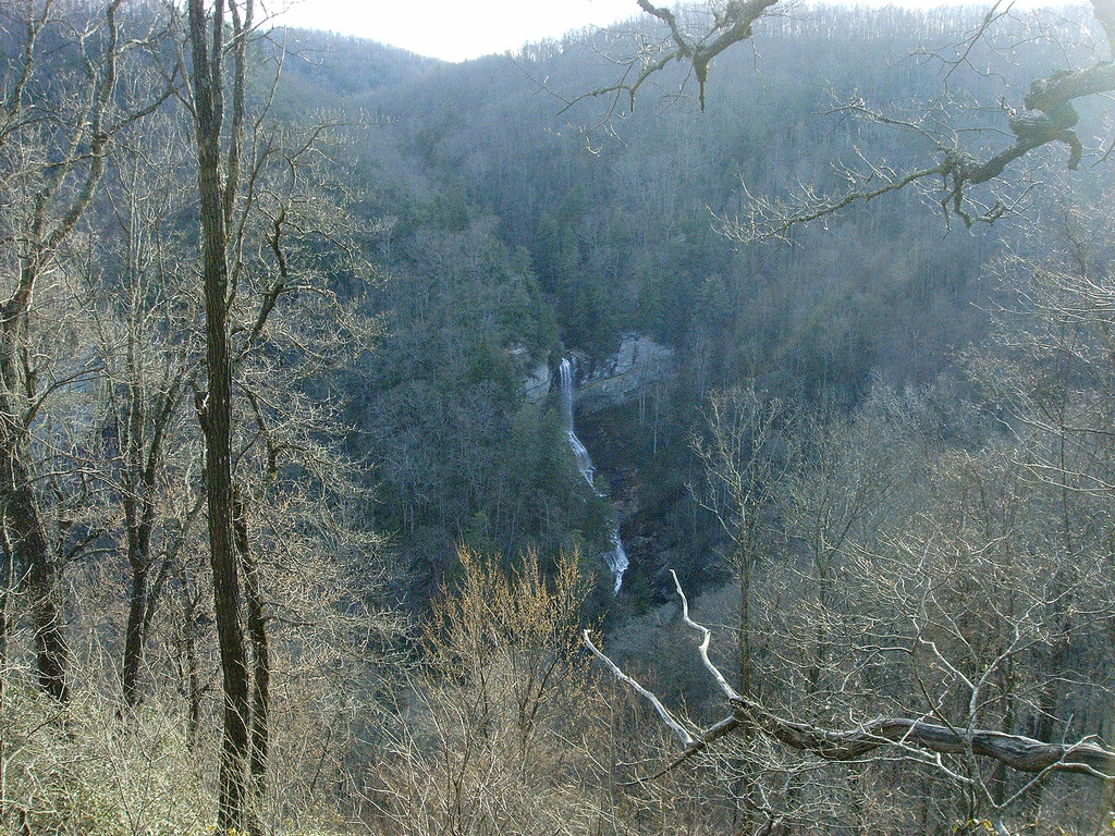

A major Upstate waterfall viewed from trails in the Mountain Bridge Wilderness Area. This page provides a verified planning overview and links to the managing authority for current operational details.
Original trip-planning analysis
Plan your Raven Cliff Falls visit
Raven Cliff Falls is a mountain trail outing where rain, thunderstorms, heat, daylight, slippery footing, and trail operations matter more than a single headline forecast. Use the representative weather point as a starting check, not a description of the full route.
How does recent weather affect the hike?
Recent rain can change footing, stream crossings, mud, and waterfall flow, while thunderstorms create exposure and falling-limb concerns. Dry, hot weather can reduce water flow while increasing heat stress.
What should be confirmed before driving to the trailhead?
Check the managing park source for trail, parking, gate, and access notices. Allow enough daylight for the chosen route and carry navigation rather than relying on connectivity.
Common planning questions
Frequently asked questions
Does this page show live waterfall flow?
No. SC Outdoor Check does not claim a supported live flow station for Raven Cliff Falls.
Can the trail differ from the mapped weather point?
Yes. Elevation, forest cover, terrain, drainage, and localized storms can create different conditions along the route.
Does no weather alert mean the trail is open?
No. Weather alerts and managing-authority trail status are separate checks. Use the official source before departure.
Connected official data
Relevant condition signals
Hiking
- Weather
- Favorable
- Activity
- Insufficient Data
- Confidence
- Partial
Insufficient critical data for a favorable activity rating.
Last official observation: Sep 8, 9:35 AM EDT
Contributing official sources: NWS
Missing critical checks: connected managing-authority closure feed
This rating is intentionally limited until the missing critical sources are checked.
Scenic Overlook
- Weather
- Favorable
- Activity
- Favorable
- Confidence
- Complete
Available official signals look favorable for planning.
Last official observation: Sep 8, 9:35 AM EDT
Contributing official sources: NWS
Official observations are planning signals, not a safety guarantee.
Overall visit
- Weather
- Favorable
- Activity
- Insufficient Data
- Confidence
- Partial
Insufficient critical data for a favorable activity rating.
Last official observation: Sep 8, 9:35 AM EDT
Contributing official sources: NWS
Missing critical checks: current USGS water data, connected managing-authority closure feed
This rating is intentionally limited until the missing critical sources are checked.
Source-by-source coverage
Condition coverage for this place
Only relevant modules are shown. “Connected” is retrieved here; “Official check” links to a source that still requires a manual check.
Retrieved for this destination.
Retrieved for this destination.
No supported live source is configured for this destination.
No supported live source is configured for this destination.
Use the linked official source; this signal is not retrieved yet.
Check official status ↗Before you leave
Access and practical details
- Hours
- Gate, office, facility, and seasonal hours may differ. Check the official source before departure.
- Fees
- No fixed fee is asserted here because admission, parking, tour, and overnight charges can change. Check the official source.
- Parking
- Use the official trailhead; roadside or shoulder parking is not assumed to be permitted.
- Accessibility
- Accessibility varies by access point, trail, and facility. Review the managing source or contact the site for the current accessible route.
- NWS weather and alerts are connected for this verified coordinate.
- Use the official destination page for current closures and operational notices.
Planning notes reviewed 2026-08-01 from theofficial managing source. Hours, fees, access, and facilities can change seasonally.