Official notices
Active alerts
Know the place
Overview
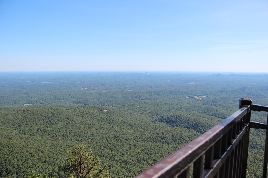

Caesars Head State Park is a South Carolina State Parks destination in Greenville County with official planning information for camping, fishing, hiking, scenic overlooks, wildlife viewing. The official park finder lists camping, fishing, hiking, scenic overlooks, wildlife viewing. Use the park page for current hours, access, and reservations.
Original trip-planning analysis
Plan your Caesars Head State Park visit
Caesars Head sits on an exposed Blue Ridge escarpment where cloud, wind, storms, and visibility can change the value of an overlook or hike. Pair the representative weather reading with an official park and trail-status check.
What makes a good overlook day?
Low precipitation risk, manageable wind, and clear visibility matter more than temperature alone. A pleasant forecast can still produce limited views when the escarpment is in cloud or haze.
What should hikers verify separately?
Confirm the selected trail, parking area, gate, and any seasonal or maintenance notice with South Carolina State Parks. Weather at the mapped point cannot confirm that a trail or overlook is open.
Common planning questions
Frequently asked questions
Does this page provide live visibility?
No. Visibility remains an official or on-site check; SC Outdoor Check does not infer a guaranteed view from a general forecast.
Can wind be stronger at the overlook?
Yes. Exposed overlooks and ridges can feel windier than sheltered roads or lower terrain near the representative point.
Are Caesars Head and Jones Gap the same access point?
No. They are related Mountain Bridge destinations with different access and trail plans. Use the specific official page for the place you intend to visit.
Connected official data
Relevant condition signals
Fishing
- Weather
- Favorable
- Activity
- Insufficient Data
- Confidence
- Partial
Insufficient critical data for a favorable activity rating.
Last official observation: Sep 8, 9:35 AM EDT
Contributing official sources: NWS
Missing critical checks: connected water and access conditions
This rating is intentionally limited until the missing critical sources are checked.
Hiking
- Weather
- Favorable
- Activity
- Insufficient Data
- Confidence
- Partial
Insufficient critical data for a favorable activity rating.
Last official observation: Sep 8, 9:35 AM EDT
Contributing official sources: NWS
Missing critical checks: connected managing-authority closure feed
This rating is intentionally limited until the missing critical sources are checked.
Scenic Overlook
- Weather
- Favorable
- Activity
- Favorable
- Confidence
- Complete
Available official signals look favorable for planning.
Last official observation: Sep 8, 9:35 AM EDT
Contributing official sources: NWS
Official observations are planning signals, not a safety guarantee.
Overall visit
- Weather
- Favorable
- Activity
- Insufficient Data
- Confidence
- Partial
Insufficient critical data for a favorable activity rating.
Last official observation: Sep 8, 9:35 AM EDT
Contributing official sources: NWS
Missing critical checks: connected managing-authority closure feed
This rating is intentionally limited until the missing critical sources are checked.
Source-by-source coverage
Condition coverage for this place
Only relevant modules are shown. “Connected” is retrieved here; “Official check” links to a source that still requires a manual check.
Retrieved for this destination.
Retrieved for this destination.
Use the linked official source; this signal is not retrieved yet.
Check official status ↗Not retrieved by SC Outdoor Check. Confirm current operations on the official park page before departure.
Check official status ↗Managing-authority check
Check current park operations
Manual official checkSC Outdoor Check does not retrieve a live closure feed from South Carolina State Parks and does not infer that this park is open or closed. Review the official park page before departure for:
- Park, gate, and facility operations
- Trail, swim-area, and amenity closures
- Capacity, reservation, and seasonal notices
Before you leave
Access and practical details
- Hours
- Gate, office, facility, and seasonal hours may differ. Check the official source before departure.
- Fees
- No fixed fee is asserted here because admission, parking, tour, and overnight charges can change. Check the official source.
- Parking
- Main, trailhead, boat-access, and overflow parking may be separate. Use the official park page to plan arrival.
- Accessibility
- Accessibility varies by access point, trail, and facility. Review the managing source or contact the site for the current accessible route.
- Operational details are maintained by South Carolina State Parks.
- Representative point at the official visitor address; confirm the entrance on the park page.
- Officially listed activities: camping, fishing, hiking, scenic overlooks, wildlife viewing.
Planning notes reviewed 2026-08-01 from theofficial managing source. Hours, fees, access, and facilities can change seasonally.